The propagation of tsunami waves is described well mathematically by a set of non-linear shallow water equations. If a physical phenomenon is described in the computer, the first step is to capture the model physics in the language of mathematics and decide what absolutely needs to flow into the simulation and what can be simplified.
Shallow water equations are derived from two important physical and basic principles, the conservation of mass and linear momentum, and describe the horizontal particle velocity and the deflection of the sea level.
The conservation of linear momentum determines the change of the particle velocity that is dominated by the earth's gravitational pull with a tsunami. The water that is pushed upwards by a quake aims to return to equilibrium. Additional important aspects are the Coriolis force (effect of the earth's rotation), the ground friction, the viscosity (internal friction) and the non-linear advection (the tsunami interacts with itself).
The conservation of mass determines the change of sea level, which rises or falls by precisely the contribution of the water inflow or outflow. The water depth is crucial for this, from which the mass of water inflow or outflow at a location results in conjunction with the particle velocity.
From both of these equations, the typical propagation of tsunamis with long, flat, fast waves in deep ocean to short, high slower waves in coastal regions can be derived and the wave height at the coast can be assessed well.
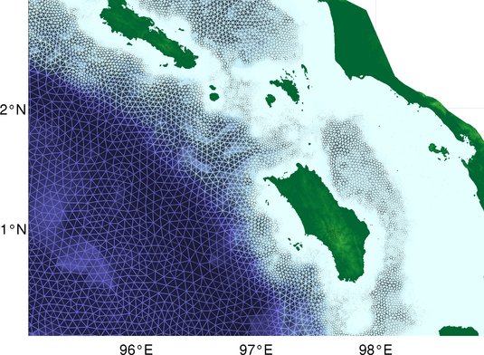
Scientists at the Alfred Wegener Institute, Helmholtz Centre for Polar and Marine research (AWI) have developed the TsunAWI simulation program, which evaluates the shallow water equations in computational grids, which are specifically adapted to the course of tsunami waves. The grid for Indonesia is comprised of 14 million triangles with edge lengths of 50 metres in the range of tide gauges of up to 12 kilometres in the deep ocean. This way, the long waves in deep oceans can be mapped well, in addition to irregular coastlines and short tsunami waves in shallow water.


