Automatic, near real time processing of GPS-data
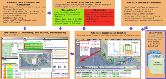
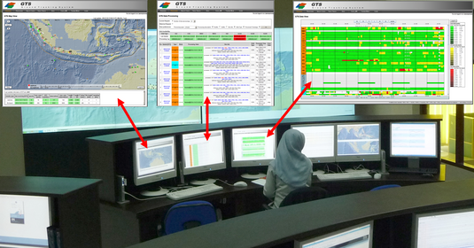
The demand for high accuracy requires the use of high-quality, geodetic GPS measurement equipment, but also careful processing of the GPS raw data. Fast availability of GPS-based products can only be achieved through an automated data processing system. An automatic system for the processing of GPS data was developed within the GITEWS project by GFZ and integrated into the Indonesian Tsunami Early Warning Centre (InaTEWS) in Jakarta (Figure 1). This system has been in operation since the end of 2008.

